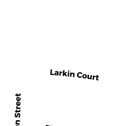
5 LARKIN CT
Owner Information
PINKHASOV ALBERT AND PINKAS
5 LARKIN CT
CANTON, MA 02021


Property Details
5 LARKIN CT is classified as a Developable Residential Land.
5 LARKIN CT is valued at $408,800. The land is valued at $408,800 and the structures are valued at $0.
This property is in Zone SRB. Confirm with local Zoning Board authorities to ensure there are no overlays or other easements on this property.
The most recent deed for 5 LARKIN CT is recorded at the local registrar in Book 38946, Page 487. 5 LARKIN CT was last sold on Monday, February 1, 2021 for $395,000.
Assessment data from fiscal year 2022.
Flood Data
According to the FEMA National Flood Hazard Layer, this property does not appear to be in a flood zone. It may also be in an area not yet reviewed. Nonetheless, confirm this information prior to taking any action.
To view the flood hazards around this property, create a FEMA "Firmette" Map of the area around 5 LARKIN CT.
Broadband Internet Providers
| Provider | Type | Bandwidth (mbps) | |
|---|---|---|---|
| Verizon New England Inc. | DSL | 15 | 1 |
| VSAT Systems, LLC. | Satellite | 2 | 1 |
| HughesNet | Satellite | 25 | 3 |
| GCI Communication Corp. | Satellite | 0 | 0 |
| Comcast | Cable | 1000 | 35 |
| Crown Castle Fiber | Fiber | 0 | 0 |
| Verizon New England Inc. | Fiber | 940 | 880 |
| Viasat Inc | Satellite | 100 | 3 |
Broadband service provider data from December 2020.
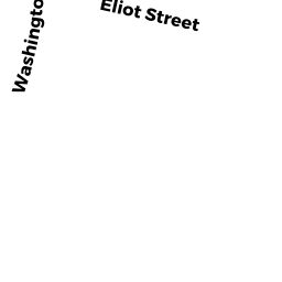
Adjacent Properties
- 0 WASHINGTON ST
Undevelopable Residential Land owned by CANAL PROPERTIES L L C - 26 ELIOT ST
Single Family Residential owned by RANDO THELMA - 1147 WASHINGTON ST
Single Family Residential owned by L AND S REALTY TRUST - 15 LARKIN CT
Single Family Residential owned by SOLOPERTO JENNIFER M AND MARK - 20 ELIOT ST
Single Family Residential owned by MCDONOUGH DENISE M